Introduction to Hovermap
Contents
Introduction
Hovermap is a smart mobile scanning device that provides autonomous mapping in challenging, inaccessible areas. It uses sophisticated SLAM (simultaneous localization and mapping) technology, allowing for the collection of accurate 3D LiDAR data in almost all environments. With no GPS required for mapping, you can use Hovermap indoors, outdoors, and underground.
Hovermap can easily be mounted to a drone or vehicle, or you can perform a walking or backpack-mounted scan. Switching between these options is easy, with Hovermap’s quick-release mechanism.
Hovermap is lightweight, yet robust enough to withstand the demands of harsh environments. Made from a combination of machined aircraft-grade aluminum and reinforced polypropylene components, Hovermap is light, yet strong enough to support its rotating LiDAR while remaining stable in flight.
Benefits of Hovermap
- Safety: Eliminates the need for people to enter hazardous areas.
- Access: Allows you to capture data in areas not possible with other technologies.
- Efficiency: Enables you to survey areas very quickly (including setting up and packing away).
- Ease of use: Simplifies your operation, with autonomy and collision avoidance.
- Versatility: Hovermap can be mounted according to specific needs, allowing you to use it in many different and creative ways. Hovermap can be used for a wide variety of commercial applications, including mining, construction and engineering, geospatial, and public safety.
- Rich, survey-grade datasets: Allows you to create dense and detailed point clouds. The automated ground control feature automatically georeferences point clouds, providing survey-grade accuracy.
- True color scans: With Hovermap’s optional colorization feature, you can add a new level of reality to your 3D point clouds.
Mission modes
There are three autonomy modes for Hovermap, providing options for every scanning need.
Mapping mode
Mapping mode gives you fast, accurate, high-resolution mobile scanning of environments where autonomy is not required. Hovermap can be used for walking or backpack-mounted scans, lowered in a cage, or attached to a vehicle or a pole. It can also be attached to a drone and used in Mapping mode (if autonomy capability is not required).
Pilot Assist mode
Pilot Assist mode provides safe, line-of-sight flight, collision avoidance, and stability control in GPS-denied environments, allowing you to fly indoors or closer to structures. It uses SLAM technology to protect and stabilize your drone. In addition to simply collecting points, the LiDAR sensor is integrated into the drone’s flight control system. Features are identified as the point cloud is created, giving the drone an awareness of its surroundings. This feature allows the drone to fly safely, creating a virtual elliptical shield (Shield) around it.
Autonomy
Autonomy enables Hovermap to operate beyond line of sight and communications range, even in GPS-denied environments. Operators can simply tap and drag to define 3D exploration zones, or place smart waypoints directly on the live-streamed point cloud. Hovermap will then plan an efficient, safe path through the environment, autonomously exploring the defined area or navigating to each waypoint. It also intelligently calculates and optimizes the return path, ensuring adequate battery capacity to return home safely. This streamlined approach simplifies mission planning, reduces setup time, and enables safer, more efficient autonomous operations.
Specifications
Hovermap Interfaces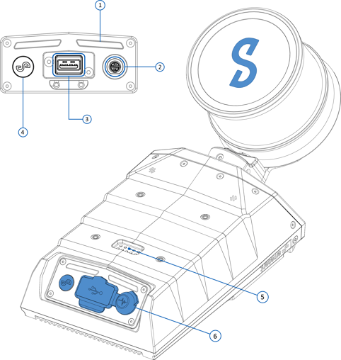
- Status LEDs
- Fischer connector
- USB connector
- Power button
- Smart connector (interfaces with accessories)
- Protective cover
Hovermap ST
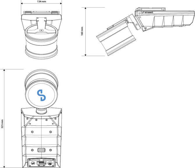
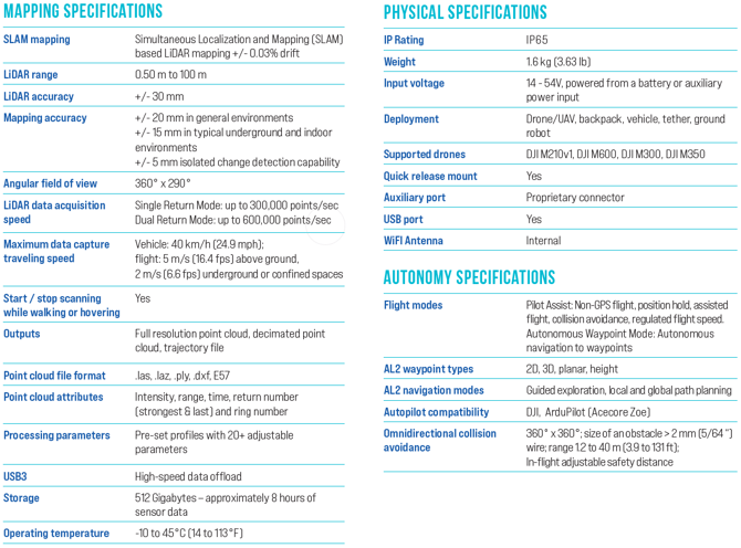
Hovermap ST-X
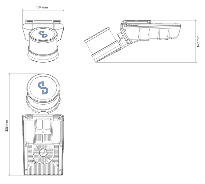
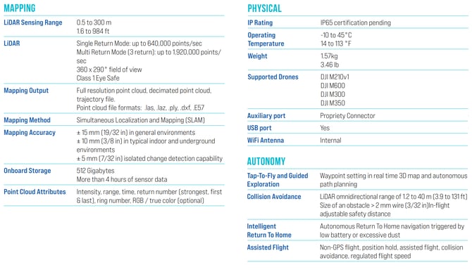
Inclusions
Standard Hovermap kit

-
Hovermap
-
Long Range Radio (optional)
-
GoPro mount (optional)
-
Cable bag: Contains 1 battery cable for waling scans (1.5m)
-
Battery
- GoPro (optional)
- Belt clip
-
International adapter (US/Canada, Australia/New Zealand. Europe/Japan)
-
Handle
-
Hovermap manual (on USB flash drive)
- Hovermap software license dongle
- Quick start guide
- Charger
Platforms available
The following platforms are available for Hovermap:
- DJI M300
- DJI M350
- Freefly Astro (ST-X only)
- Freefly Astro Max (ST and ST-X)
The following table lists the mission modes supported on each platform:
| Platform | Supported Controller | Mapping | Pilot Assist | Autonomous |
| DJI M300 |
DJI Smart Controller Enterprise |
|||
| DJI M300 |
DJI Smart Controller Enterprise |
|||
| Freefly Astro & Astro Max |
Freefly Pilot Pro |
Warning
The M300 needs to be updated to the latest firmware to be able to support the Pilot Pro controller. A firmware update will wipe the Barometer Modification settings (if any).
Accessories available
The following accessories are available for Hovermap.
- Backpack kit
- Boom pole kit
- Car mount kit
- Cavity Monitoring System (CMS) pole kit
- Hovermap protective cage kit
- 360 Colorization kit
- Long range radio kit
- Automated ground control targets
- Battery fast charger kit
- Handheld 360 Image Extraction kit
- Hovermap-Astro Interface kit
- Spot Cage for Hovermap
- Vehicle RTK kit
- Backpack RTK kit
